

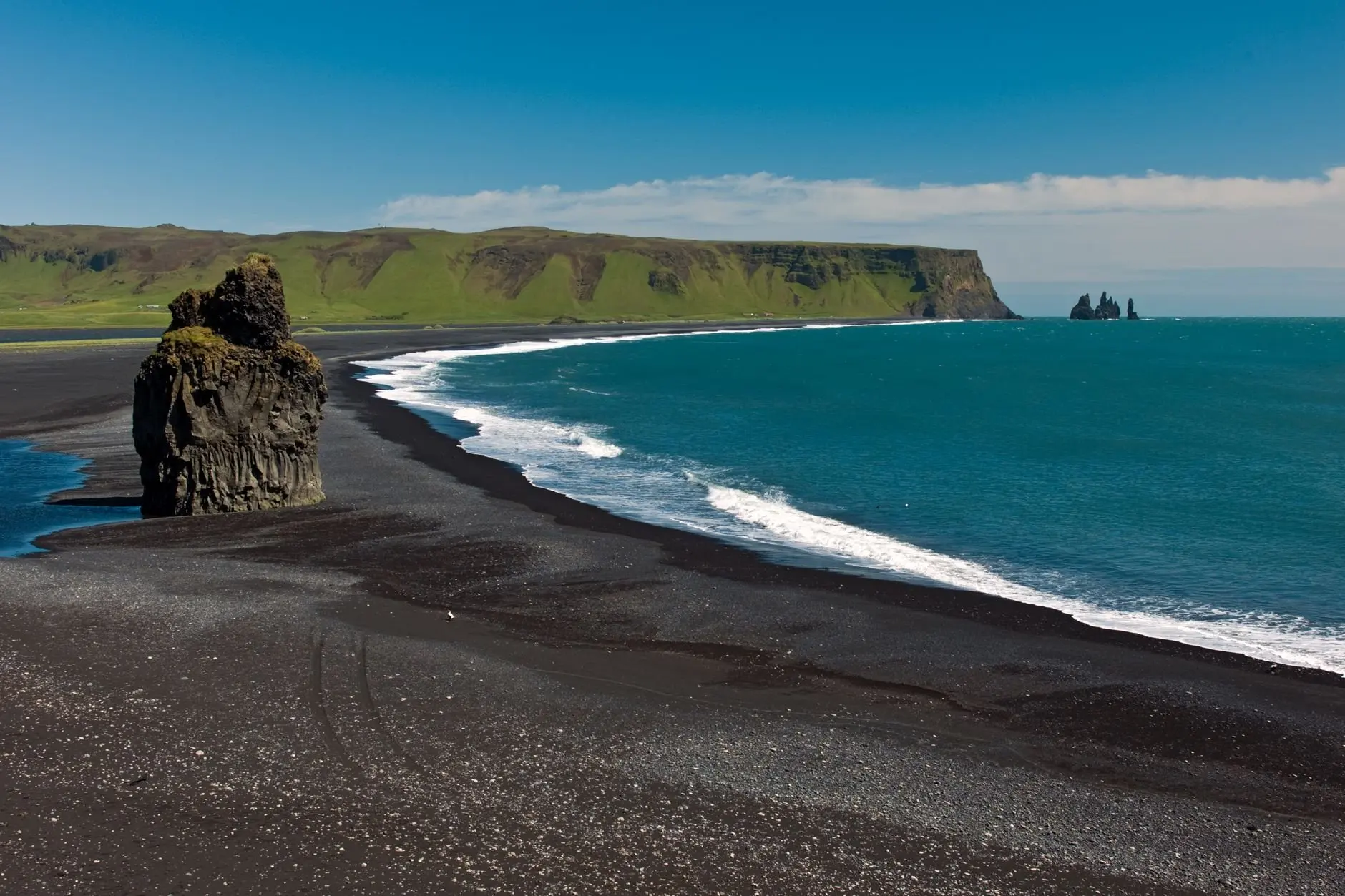
An iceland south coast itinerary works best at 1-4 days, the span most people spend, following the Ring Road from Seljalandsfoss and Skógafoss to Reynisfjara, Vík and Jökulsárlón. Weather decides how far east you get, so keep slack in the plan.
This guide pairs the scenery with folklore, museum and lighthouse stops. For the wider method behind trips like this, see how to plan a cultural heritage trip.
How many days the south coast needs
The Iceland south coast needs as many days as you want to spend reaching its eastern end, because every major stop sits along one road. Visit Iceland describes the route as approx. 480 km from Þorlákshöfn to Höfn and suggests 1-7 days. Another planning guide measures the road at 401 km from Selfoss to Höfn. The coast is reached via the Ring Road (Route 1), and it stretches from Reykjavík to the Jökulsárlón glacier lagoon in the east.
Because there is only one main road, extra days do not open new loops. They buy longer stops, a slower pace or an overnight further east. That gives three practical choices:
- Shorter trip: Stay in the western half and treat Seljalandsfoss, Skógafoss, Reynisfjara and Vík as the goal. This suits travellers who want scenery without long driving days.
- Standard trip: Typical south coast tours link Seljalandsfoss, Skógafoss, Vík and Jökulsárlón. This suits most first-time visitors who accept a long driving day to reach the lagoon.
- Longer trip: Use the upper end of the range to add the heritage stops below, sleep further east and keep a spare day in case weather blocks the road.
If you only have a layover rather than a road trip, Perfect Iceland Stopover Itinerary: Make the Most Of 24–72 Hours In Reykjavík And Beyond (2026 Guide) – Scanheritage covers a shorter Reykjavík-based option.
Stops in driving order
Travelling east from Reykjavík, the stops arrive in a fixed order: waterfalls first, then the black-sand coast at Vík, then the glacier lagoon. The table gathers the practical details for each.
| Stop | Key detail | Planning use |
|---|---|---|
| Seljalandsfoss | Drops 60 m; a footpath runs behind the falls | Allow time for the walk behind the water, so it is more than a roadside photo stop. |
| Skógafoss | 60 m tall and 25 m wide; a short walk from the parking lot, right off Route 1 | An easy stop that fits into a full driving day. |
| Kvernufoss | Park at the Skógar museum and follow the trail | Combine it with the museum visit rather than treating it as a separate detour. |
| Reynisfjara | Not a swimming beach; visitors have been swept away by sneaker waves | A viewing stop only; stay back from the water. |
| Vík or Höfn | Named as the best overnight bases | Choose Vík for the western half and Höfn for the eastern end. |
| Jökulsárlón | Iceberg-studded lagoon at the eastern end of typical tours | The anchor stop that decides whether you need the longer trip. |
Figures come from Erika’s Travels and A Couple Days Travel.
Seljalandsfoss and Skógafoss
Both waterfalls sit beside the main road, so they suit the first leg of the drive. Visit east of them only once you have seen these two, because they are the stops most likely to be done in good light early in the day. Seljalandsfoss rewards a slower visit because of the path behind it. Skógafoss is quick to reach and can be fitted in even when the schedule is tight.
Reynisfjara and Vík
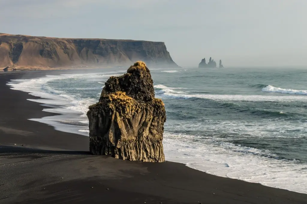
Reynisfjara sits at Vík and delivers the dramatic black-sand scenery most south coast photographs show. Treat it as a place to look from a safe distance, not a beach to explore at the waterline; the safety section below explains why. Vík is the practical pause in the middle of the route, with the beach on its doorstep.
Jökulsárlón and the eastern end
Jökulsárlón is the stop that stretches a day trip into an overnight trip. It lies at the far end of the typical route, and the stretch beyond Vík is where weather is most likely to change your plans, as the driving section explains. If the lagoon is your priority, plan for the longer end of the day range and keep it as the last stop of the outbound drive.
Heritage and cultural stops
The south coast offers folklore, museums and lighthouses alongside its landscapes, and these stops suit travellers who want context for what they are looking at. Visit Iceland pairs the petrified trolls of Reynisfjara beach in Vík with the coast’s scenery, so the same beach works as both a scenic and a folklore stop.
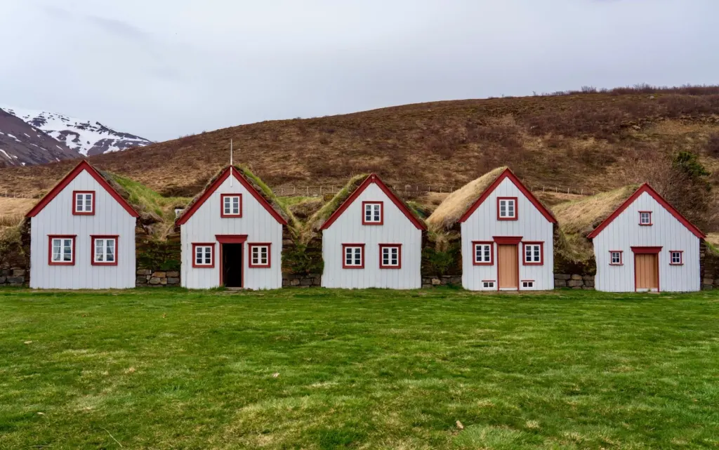
- Museums and exhibitions: Visit Iceland notes museums and exhibitions about earthquakes and volcanic eruptions, elves, trolls, ghosts, and marine history. They are useful rain-day alternatives to outdoor stops.
- Skógar museum: It is the parking point for the Kvernufoss trail, which makes it an easy cultural stop to combine with a waterfall walk.
- Lighthouses: The same Visit Iceland guide describes three lighthouses in Þorlákshöfn, Eyrarbakki and Stokkseyri that can be combined with outdoor activities. They lie at the western start of the route, so they suit a slower trip rather than a rushed one.
Travellers who enjoy comparing Nordic customs can pair this route with Norwegian Wedding Traditions: Timeless Customs, Lively Celebrations, and What To Expect in 2026 – Scanheritage for a contrasting tradition from the region.
Driving and winter conditions
The south coast is a manageable drive, but winter turns it from a routine drive into a conditional one. One planning guide says the roads are well paved and easy to traverse with any vehicle, and that Route 1 generally stays open year round while other roads close due to weather. The same guide adds that southern Iceland is only truly accessible from April to September.
Winter driving
The Ring Road generally stays open year round, so a winter south coast trip is possible. Weather can still end the day early: on a self-guided drive, conditions past Vík simply did not permit finishing the drive. In winter, treat Vík as a realistic turning point and Jökulsárlón as a bonus. Check the Icelandic road and weather services each morning before committing to the eastern leg, and keep a spare day in the schedule.
Fuel and navigation
For remote stretches, the same guide advises a full tank of gas and a functioning Iceland road map or GPS. Fill up before leaving the larger towns rather than relying on the next station being close.
Beach safety at Reynisfjara
Reynisfjara is a place to watch the sea, not to enter it. One guide states plainly that it is definitely not a swimming beach, and another warns that beaches in southern Iceland are not for swimming and that tourists have been snatched by sneaker waves and drowned.
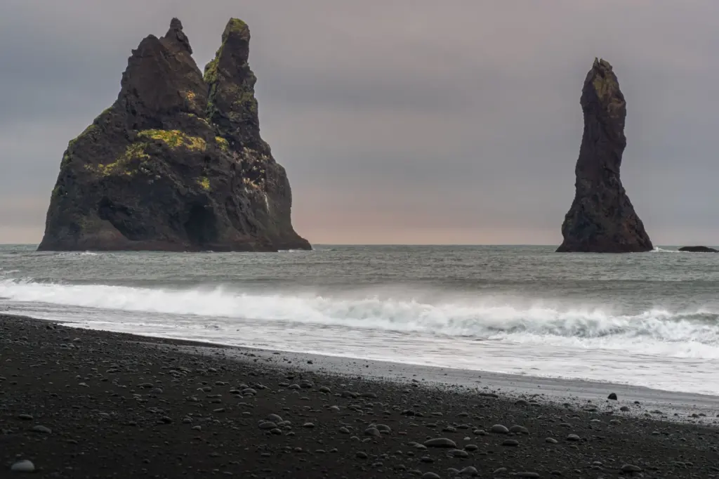
In practice, that means staying well back from the waterline, never turning a photo into a reason to move closer to the surf, and keeping children close. The same caution applies to every black-sand beach along the route, not only Reynisfjara.
Where to stay
Vík and Höfn are the two overnight bases worth planning around. A travel guide says that if you are staying overnight, Vík or Höfn are the best places to stay. Vík suits shorter trips because it sits beside Reynisfjara and splits the drive in the western half. Höfn suits longer trips because it is the eastern end of the route and puts Jökulsárlón within easy reach for the final leg. Seljalandsfoss and Skógafoss work best as daytime stops on the way to either base, not as places to sleep.
Frequently asked questions
Can you take a boat on the glacier lagoons?
Yes. Visit Iceland says boat and kayak tours navigate between small icebergs at the Fjallsárlón and Jökulsárlón glacier lagoons.
Which waterfalls are closest to the Ring Road?
Visit Iceland names Skógafoss, Seljalandsfoss and Gljúfrabúi among some of Iceland’s most famous waterfalls that are very close to the Ring Road.
When is the best time to travel?
Visit Iceland lists the south coast as a year-round destination, with summer best for hiking.
What is Vatnajökull National Park?
It was established in 2008, covers 13% of Iceland and encompasses all of Vatnajökull, Europe’s largest glacier.